When I was very young, World War II was underway. I’d been born six months before Pearl Harbor and thus was three in 1944 when I developed a fascination for the maps on the pages of the newspaper my father read at the dinner table each evening. They showed troop movements in Europe and the paths of ships and aircraft in the Pacific. I saw them upside down, of course, and that was how I learned to read, picking out the letters in the headlines and the legends on the maps. That fascination—both with maps and with World War II—has stayed with me all my life. And that recently led me to pick up The Historical Atlas of World War II by Alexander Swanston and Malcolm Swanston, two British cartographers and writers.
An imperfect portrayal of World War II
The Swanstons’ work depicts the war’s principal events over the six-year period from the Nazi invasion of Poland in September 1939 until the Japanese surrender in September 1945. (The authors ignore the prior events in the Far East beginning in 1931 in Manchuria.) The heart of the book consists of 170 full-color maps (though the cover says 140), surrounded by narrative text that sums up the action pictured. It’s a less than comprehensive account of the war, since the authors portray it almost exclusively as a succession of individual military campaigns and battles. Of course, World War II—”the most cataclysmic event in history,” as the cover announces—was all-consuming. Political, social, economic, psychological, and other factors loomed large in the war, too. There’s little hint of those broader dimensions.
The Historical Atlas of World War II by Alexander Swanston and Malcolm Swanston (2007) 400 pages ★★★☆☆
A strong pro-British bias
The authors are British, and it shows. Although World War II started at least two years earlier in Asia than in Europe—some would say eight years—the book’s first hint of war in the Pacific comes only on page 144. And the entire war in Asia and the Pacific claims only 94, or 25 percent, of the 377 pages of text and illustrations.
The Swanstons devote 12 pages to the back-and-forth battles in the Western Desert of North Africa from 1940 to 43, when British, Indian, and Australian troops faced off against the Italians and (later) Germans. That chapter is exceeded in length only by the 14 pages devoted to the Battle of Normandy in 1944. And Operation Barbarossa, Hitler’s invasion of the Soviet Union, claims only nine pages. It was by far the largest military operation in the history of the world—and, many historians assert, the strategic event that doomed the Third Reich.
Many annoying errors
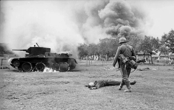
The Historical Atlas of World War II abounds with colorful maps and rarely seen photographs that bring many of the events of the conflict into vivid relief. It was an ambitious project, and successful up to a point. However, the book is marred by maps that are often so complex as to be difficult to follow and photographs that are unfocused and foggy. Also, there are innumerable small errors, such as misspellings, sentence fragments, and run-on sentences. The copy appears to have been hastily written and published without review by an editor. While the errors are sufficiently minor, they cast doubt on the care with which the authors (and the publisher) prepared the book.
About the authors
As Google Books reveals, Alexander Swanston “has worked on over 30 historical titles, creating the cartography and layout, along with picture editing.” His books include The Historical Atlas of World War II and the Atlas of Air Warfare. The latter has been translated into seven different languages.
Malcolm Swanston‘s Canadian publisher notes that “Alexander Swanston and Malcolm Swanston have been writing about and mapping history collectively for over 30 years, working on subjects ranging from ancient Rome to Vietnam and beyond. They have researched and written about World War II for many years and have mapped the key battles and events that took place between 1939 and 1945. They have recently produced books on a range of subjects, including The Atlas of the Civil War, The Historical Atlas of the Bible, and The Historical Atlas of Knights and Castles.”
For more reading
I’ve read and reviewed a much better World War II atlas: Atlas of World War II: History’s Greatest Conflict Revealed Through Rare Wartime Maps and New Cartography by Neil Kagan and Stephen G. Hyslop (A World War II atlas from an American perspective).
- 10 top nonfiction books about World War II
- Books about World War II in the Pacific
- The 10 best novels about World War II
- 15 good books about the Holocaust, including both fiction and nonfiction
- 7 common misconceptions about World War II
- The 10 most consequential events of World War II
And you can always find my most popular reviews, and the most recent ones, plus a guide to this whole site, on the Home Page.